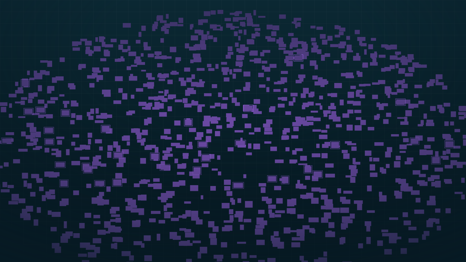

Drone roof inventory: the exact number of tiles
Counting tiles or measuring a roof means climbing onto it, with the risk and time that entails, or estimating by eye and burying the error in the quote. A twenty-minute flight solves both.
«A twenty-minute flight and a report with the exact number of tiles. No scaffolding, nobody on the roof, and a count you can take straight to the estimate.»
- Client
- Contractors, building engineers, surveyors, heritage bodies, insurers
- Input
- Drone flight, 10 – 20 m above the pitch
- Gimbal
- Perpendicular to the roof plane
- Resolution
- ≈ 0.5 cm per pixel (GSD)
- Technique
- 100 % bespoke model, tiled inference
- Output
- Count, area, density per m², annotated PDF report
What you get
A piece count, the pitch area, density per square metre and a PDF report with the annotated image, piece by piece. It is the document that holds up a materials quote without a safety cushion.
Between two flights separated in time you can see what has shifted or broken. That turns a one-off measurement into preventive maintenance, and into evidence usable with an insurer.
Why a bespoke model is required
The Mallorcan roof tile is in no public dataset. None. The model is trained from scratch on images of real roofs, and that is exactly what makes the count reliable.
Flying between ten and twenty metres above the pitch, gimbal perpendicular to the plane, yields about 0.5 cm per pixel. That figure — the GSD, the centimetres of reality each pixel covers — is what makes counting pieces possible, and it is what justifies the flight altitude.
In scenes this dense, inference is tiled: the image is sliced, detection runs on each tile and the results are merged. Without that, a conventional detector saturates and stops counting.
Can be extended with
- Detection of broken or displaced tiles
- Flight-to-flight comparison for preventive maintenance
- Expert report for insurance
- Orthomosaic when one photo is not enough
What is GSD and why am I paying for it?
GSD is the centimetres of reality each pixel of the photo covers. Flying at ten to twenty metres gives about 0.5 cm per pixel, and below that resolution the pieces stop being distinguishable. Flight altitude is not a technical detail: it decides whether the count is possible at all.
Do you need a permit to fly?
It depends on the location and the airspace. It is part of preparing the campaign and is resolved before the flight date.
Does it work for roofs that are not tiled?
The same method works for any repeated, countable element on a plane: panels, solar modules, roofing pieces. The dataset changes, the technique does not.
Got a roof to quote?
A drone campaign costs between 450 and 900 € per building, flight, processing and report included.
Assess my scene